Scenic Drives and Easy Offroading Trails near Talladega Scenic Highway
Share
Scenic Drives and Easy Offroading Trails Near Talladega Scenic Highway: Chase the Views, Rep the Trails
Stop driving the speed limit. Start chasing the elevation. The Talladega Scenic Highway (AL-281) might be paved, but it’s just the starting line. Flanked by the legendary Talladega National Forest and crowned by Cheaha Mountain, this region is a postcard waiting to be stamped by your 4x4’s tires. We know the pavement is nice, but we built our rigs to find the views off the map.
This isn't about white-knuckle rock crawling—it's about the pure freedom of an accessible 4x4 trail that rewards you with epic views. It's the perfect route for a weekend journey, whether you're breaking in a new rig or just looking for a low-stress way to introduce the family to the dirt. You’re trading billboards for ridge lines and traffic jams for trail silence. We’re going to show you where to find those sweet spots where the asphalt ends and the authentic adventure begins. Gear up, because it’s time to explore the dirt roads that make this place a Southern treasure.
I. The Scenic Gateway: Talladega Scenic Drive (AL-281)
Consider the Talladega Scenic Highway your 4x4’s staging area. This ribbon of road winds along the spine of the Appalachian foothills, offering views that will genuinely slow you down. It’s like the Blue Ridge Parkway’s rugged little brother—less crowded, just as beautiful, and way closer to the real dirt.
The High Point: Conquering Cheaha Mountain
Your first mandatory stop is Cheaha Mountain, Alabama's highest point. The views from the Cheaha State Park observation tower are stoked-worthy, giving you a panoramic look at the massive Talladega National Forest you’re about to dive into. It’s a great spot to park up, stretch your legs, and finalize your navigation plan. You can see the dark green forest canopy spreading out like a wrinkled blanket, marking the routes of the easy offroading trails below.
Action Point: Before you leave the pavement, grab a current map from the Cheaha State Park or the nearby Shoal Creek Ranger District office. Cell service up here is fickle, and a paper map or a downloaded offline app is the only navigation you can truly trust when you hit the dirt.
Pavement to Power: Finding the Dirt Threshold
The beauty of this area is that the easy offroading starts immediately off the scenic highway. You’re looking for the marked Forest Service (FS) Roads that peel off AL-281. The transition points near Adams Gap are prime examples. These roads aren’t hidden—they are clearly designated, but they require a capable vehicle, especially after a good rain. These are your gates to the journey.
When you see that FS road sign, engage 4WD—even if the road looks fine. It’s a confidence booster, it reduces wear and tear on your vehicle, and it prepares you for the inevitable soft spots. I learned that lesson the hard way in my early days. The trail was smooth, wide gravel, so I left it in 2WD. Then, around a blind corner, a sudden patch of deep, soupy red clay nearly dragged my rig into the ditch. Switching to 4-Hi at that moment felt like trying to change a tire while driving. Be action-oriented and engage early.
II. The Trailblazer Loop: FS Road 600-1 & 600-2
The FS Road 600-1 and FS Road 600-2 area is the core of the 4x4 trail experience near the Talladega Scenic Highway. This loop offers the perfect balance, ranging from smooth scenic cruising to true, though easy, wheeling.
FS 600-1 (The Cruiser): Built for Views
The Gist: FS Road 600-1 is your dream scenic drive. It’s mostly well-maintained, wide dirt and gravel—a high-clearance SUV or even a stock 4x4 with decent tires can handle this easily. This route is less about conquering obstacles and more about soaking in the forest scenery. It’s the perfect place to drop the windows, breathe the pine-scented air, and let the miles melt away.
- The Journey: Expect a relaxed pace. This route is frequently used by forest service personnel, so it stays relatively smooth.
- The Action: Send it (responsibly, of course!) on this section. It's a prime spot to test out new suspension comfort or simply enjoy the feeling of your built rig doing exactly what it was meant to do.
- Audience View to Consider: How far can a 2WD truck actually make it down 600-1 on a dry day? (The honest answer: you could probably cover most of it, but one unexpected hill or drainage rut will stop you cold. Rep your rig and use 4WD for safety and control.)
FS 600-2 (The Challenge): Earning Your Dirt Stripes
The Gist: When you hit the intersection where 600-2 begins, the road immediately changes its attitude. This is where you separate the cruisers from the crawlers. FS 600-2 has rockier sections, steeper grades, and, most importantly, significantly more mud and ruts, especially in the low-lying areas.
- The Challenge: This is where you need 4-Lo and a spotter, even if only briefly. The ruts are deeper, and the off-camber sections will give your suspension a real workout. This trail system becomes a slick, red-clay waterslide after a heavy rain.
- The Reward: Tackling 600-2 gives you access to more remote camping spots (see next section) and the genuine feeling of conquering a trail.
- Audience Question to Consider: What’s the best spot along 600-2 to practice my rock-crawling articulation? (Look for the exposed rock shelf areas on the climbs—they are forgiving but force you to manage tire placement. You'll learn the difference between a wheel lift and a hang-up fast.)
Real Example: The Photo Bomb
I remember a trip with a friend on 600-2. He was running a nearly-stock rig and feeling pretty confident on the initial sections. Then we hit a deep, water-filled mud pit that was much wider than he judged. He went in too slow, and his stock tires turned into slicks almost instantly. He was high-centered, wheels spinning uselessly. We had to break out the winch and snatch strap, turning a leisurely drive into a 30-minute recovery effort. The lesson? A spot that looks like fun can be trouble if you aren't ready to get dirty. Always rep your gear by having quality recovery gear on hand—even on "easy" 4x4 trails.
III. Combining Wheel & Camp: Primitive Hideouts
The Talladega National Forest is a paradise for overlanders because it allows dispersed camping—your rig is your hotel, and the explore mission continues right up to your fire pit. The FS Road 600-1 and 600-2 loop is lined with pull-offs and hidden clearings perfect for a secluded night.
Dispersed Camping Rules: The Tribe’s Code
Be authentic to the off-road lifestyle by being a good steward of the land. Our access to these incredible spots depends entirely on our compliance with Leave No Trace (LNT) principles. Action:
- Respect the Distance: Camp at least 100 feet from all roads and water sources.
- Pack it Out: Every piece of trash, human or animal, leaves with you. Keep the forest open for the tribe.
- Fire Safety: Check the current fire danger rating (it changes fast). Keep fires small, contained, and dead out before leaving—meaning cold to the touch.
Spotlight: The River Access Camp
For the ultimate experience, seek out a primitive site near one of the numerous creeks or streams that feed the Talladega area, like the access points near the Chinnabee Silent Trail. These spots often require the most wheeling to reach, often involving a gentle water crossing or a muddy bank approach. The reward is the sound of running water, a natural windbreak, and the perfect atmosphere for an epic campfire story.
Focus on Self-Sufficiency: Because you’re away from developed sites, water is key. While the creek is great for atmosphere, always grab a reliable water filter or bring enough potable water for drinking and cooking. You are your own support system out here.
Safety & Security: The Prepared Adventurer
A confident adventurer is a prepared one. Beyond the recovery gear, make sure your communication and medical prep is sound:
- Navigation Check: Always have a backup power source for your GPS/phone.
- Comms: Consider a handheld radio (GMRS or HAM) if traveling with others, or a satellite communicator if traveling solo or deep into the forest.
- Wildlife: Be aware of black bears (rare, but present). Use proper food storage (bear bags or sealed containers in your vehicle).
The Talladega National Forest is a massive, beautiful wilderness, and getting out here is about embracing the authentic experience. Rep your journey with a solid plan.
Conclusion: The Trail Awaits Your Mark
Talladega isn't just a scenic drive; it’s a journey with side quests designed for your 4x4. From the cruising comfort of FS Road 600-1 to the mud-testing ruts of FS Road 600-2, the Appalachian foothills give you exactly what you need: freedom and an authentic challenge.
You now have the intel to turn a simple mountain drive into a full-fledged 4x4 trail adventure. This area is accessible, stunning, and built for our community. So, plot your course, pack your gear, and get ready to explore some of the Southeast's most beautiful and accessible trails. Show your trails and leave your mark only with tire tracks and great memories.
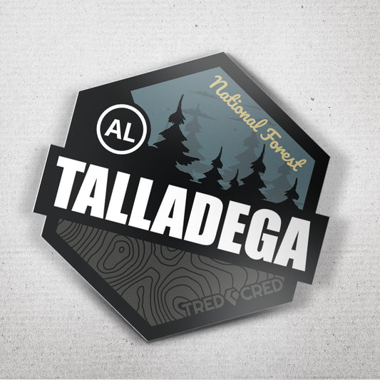
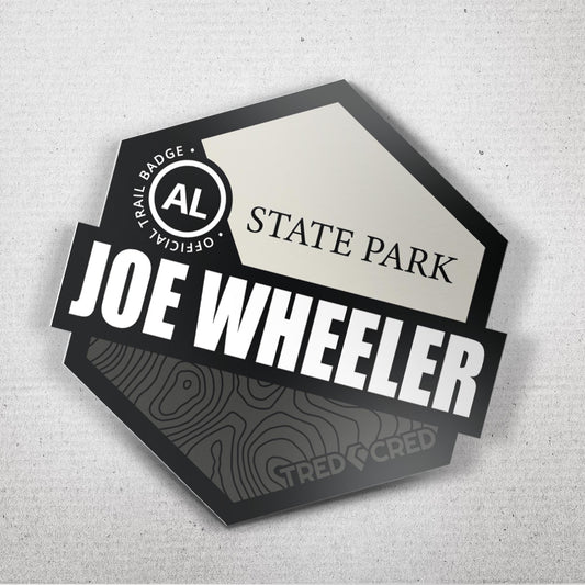
Grab the Tred Cred Talladega Trail badge or sticker—proof that you conquered the elevation and embraced the epic journey. We’ll see you on the ridge.
Tribe, hit the comments and tell us: Which is your Talladega style: Scenic Cruise (FS 600-1) or Challenge Locked (FS 600-2)?